

John Kennedy 23, 1st Floor 2314 Lakatamia, Nicosia
PO Box 23830, 1686, Nicosia
PO Box 23830, 1686, Nicosia


Based on Directive 2007/60 / EK of the European Union, Member States were required to compile flood risk maps (flood maps), which are also able to show the potential flood’s depth.
On behalf of the Republic of Cyprus, the risk mapping was carried out by the Water Development Department, which defined three levels of probability:
There are 19 potential hazard areas in the Republic of Cyprus that have been identified, concerning river flows. You can see these areas here.
The interactive maps, where you can find whether the building you are interested in will flood or not, are based on the probability levels listed above. It is important for citizens to know that flooding is not unlikely to occur in areas other than river flows if particular local factors exist (e.g in case a neighbour blocked the flow of rainwater).
|
INTERACTIVE Flood Hazard Maps Flood Risk Map with high probability (1 in 20) |
Συνοπτικός Χάρτης Περιοχών Δυνητικού Σοβαρού Κινδύνου Πλημμύρας 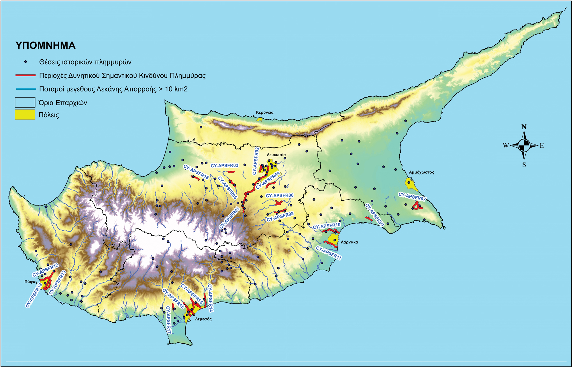 |